Image collection »Imst«
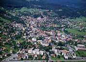
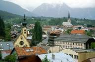
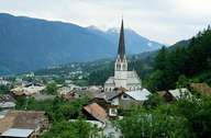
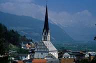
The district capital of Imst in the Oberinntal region is situated at the entrance of the Gurgeltal in the Inntal. Imst is subdivided into the so-called Ober- and Unterstadt. The centre stretches along the road. On the western slopes new houses have been built. At Brennbichl and along the Inn River industrial and commercial businesses have been established. In 1898 Imst got its city charter. Since Roman times Imst has been an important traffic junction: east-west (Inntal - Arlberg) and north-south traffic (Reschen - Fern Pass). In the Middle Ages, Imst had its heyday as a centre of mining and commerce. 8000 people were employed at the Strele Cloth Factory by the mid 18th century. At this time salesmen sold their bred singing birds all over Europe. Imst is famous for its Shrovetide (Schemenlauf). The world's first SOS children's village (an idea of Hermann Gmeiner) was built in Imst.
|
|
|
|
|
|