Tirol Atlas Archive

tiroLexikon

^UP

Image collection »Imst«

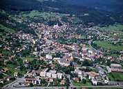
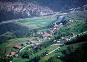
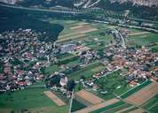
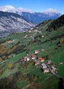
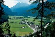
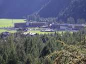
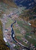
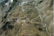
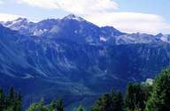
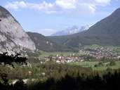
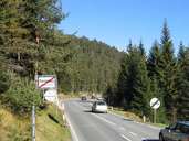
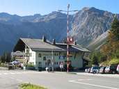
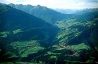
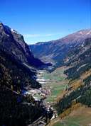
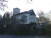
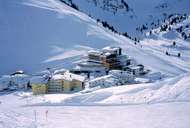
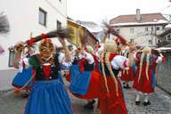
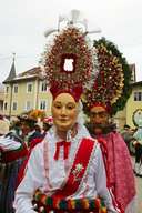
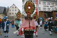
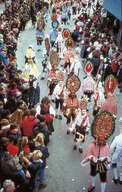
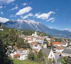
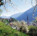
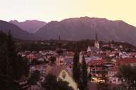
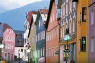
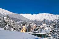
The district of Imst in the Tiroler Oberland is sub-divided into four main valleys: the Oberinntal including Imst and Haiming as the settlement centres, the Ötztal valley with its main settlements of Längenfeld and Sölden and the Pitztal and the Gurgltal. An important north-south transit route has led through the district since the Romans built a road through the Gurgltal and over the Fernpass and the geographical importance of this route has remained unbroken to the present day. From an economic point of view, above all the building trade and wood industry play an important role, while tourism dominates in the Pitztal and the Ötztal valleys and Sölden could be called a tourist hub. Put in a nutshell, the district of Imst can be described in superlatives: Sölden is the biggest community area-wise in Tyrol, the Rofenhöfe farms are the highest permanent settlement in Austria, the Ötztaler Alps are the most glaciated mountains in the Eastern Alps and Hermann Gmeiner founded the first SOS-Children's Village in Imst. Numerous landslides like, for example, on the Tschirgant and in Köfels are distinguishing features of the scenery. From the Ötztal an old mountain pass, the Timmelsjoch, leads to South Tyrol. Otzi, the approx. 6000 year-old glacier mummy was found on the Tisenjoch.

Tirol Atlas image No.°5731
Imst
Tirol Atlas image No.°5733
Imsterberg
Tirol Atlas image No.°5705
Haiming
Tirol Atlas image No.°5706
district Haimingerberg, Haiming
Tirol Atlas image No.°6469
Längenfeld basin
Tirol Atlas image No.°7504
The new "Tirol Therme Längenfeld"
Tirol Atlas image No.°6555
Stuibenfall
Tirol Atlas image No.°5974
Söden
Tirol Atlas image No.°6516
Timmelsjoch road
Tirol Atlas image No.°4330
Köfels, Umhausen
Tirol Atlas image No.°7084
Nassereith, view of Holzleitensattel
Tirol Atlas image No.°7731
Fernpass
Tirol Atlas image No.°7733
Fernpass
Tirol Atlas image No.°6226
Arzl im Pitztal
Tirol Atlas image No.°5935
St. Johann im Pitztal
Tirol Atlas image No.°3281
Pilgrimage church Maria Locherboden
Tirol Atlas image No.°6522
St. Petersberg
Tirol Atlas image No.°7526
Hotels in Kühtai (district of Silz)
Tirol Atlas image No.°8887
Imst, carnival
Tirol Atlas image No.°8888
Imst, carnival
Tirol Atlas image No.°8889
Imster Schemenlaufen
Tirol Atlas image No.°8890
Imst, carnival
Tirol Atlas image No.°8891
Imst, carnival
Tirol Atlas image No.°8892
Imst, carnival
Tirol Atlas image No.°8893
Imst, Carnival
Tirol Atlas image No.°8894
Imst, carnival
Tirol Atlas image No.°8895
Imst, carnival
Tirol Atlas image No.°8896
Imst, carnival
Tirol Atlas image No.°8897
Imst, carnival
Tirol Atlas image No.°8898
Imst, carnival
Tirol Atlas image No.°8899
Imst, carnival
Tirol Atlas image No.°8900
Imst, carnival
Tirol Atlas image No.°8901
Imst, carnival
Tirol Atlas image No.°8907
Imst, carnival
Tirol Atlas image No.°8908
Imst, carnival
Tirol Atlas image No.°8909
Imst, carnival
Tirol Atlas image No.°8910
Imst, carnival
Tirol Atlas image No.°8911
Imst, carnival
Tirol Atlas image No.°8912
Imst, carnival
Tirol Atlas image No.°8913
Imst, carnival
Tirol Atlas image No.°8914
Imst, carnival
Tirol Atlas image No.°8915
Imst, carnival
Tirol Atlas image No.°8904
Imst
Tirol Atlas image No.°8905
Imst
Tirol Atlas image No.°8903
Imst
Tirol Atlas image No.°8902
Imst, centre
Tirol Atlas image No.°8884
Imst in the wintertime
Tirol Atlas image No.°8885
Imst, parish church
Tirol Atlas image No.°8886
Imst in the winter at night
Tirol Atlas image No.°8906
Imst in the wintertime
Overview map
Topographic map
 
Further links: Hazards Chronicle Tyrol, Weblink »Imst«, Weblink »Wikipedia«, tiroLexikon