Tirol Atlas Archive

tiroLexikon

^UP

Image collection »Innsbruck«

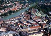
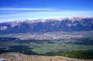
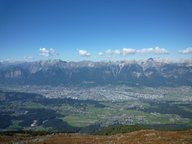
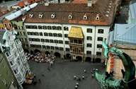
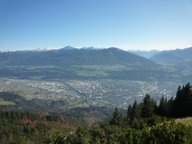
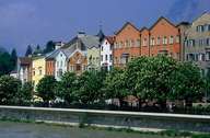
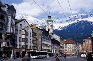
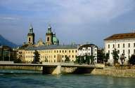
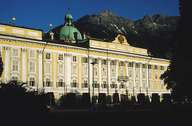
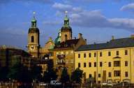
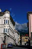
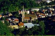
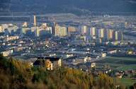
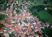
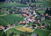
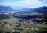
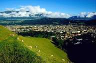
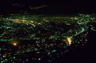
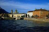
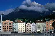
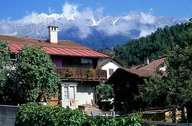
Innsbruck, Tyrol's provincial capital, is conveniently situated in the centre of the Inntal at the junction of the motorway up to the Brenner Pass and the A12. The municipal area of Innsbruck expands from Igls (where it nearly reaches the summit of the Patscherkofel) in the south, to the Praxmarerkarspitze (with its 2638 metres the highest point of Innsbruck) in the north. Innsbruck was originally founded by the counts of Andechs and received its town charter in 1239. The historic medieval town centre represents a typical Inn-Salzach-Stadt with its characteristic architectural elements. Innsbruck has grown in different phases: in the first one it grew along today's Maria-Theresienstraße with its Baroque buildings. By incorporating formerly independent communities at the beginning of the 20th century and 1940 and the expansion after 1945, Innsbruck has become the only town next to Grenoble with a population of more than 100,000 within the Alpine crescent. In 1964 and 1976 the Olympic Winter Games took place in Innsbruck. Today Innsbruck with its university (23,000 students) is the administrative, cultural and economic centre of Tyrol.

Tirol Atlas image No.°5734
Innsbruck, Old Town
Tirol Atlas image No.°1808
Innsbruck with the eastern Mittelgebirge
Tirol Atlas image No.°11703
en:Innsbruck, mit östl. Mittelgebirge
Tirol Atlas image No.°5299
Innsbruck, Golden Roof
Tirol Atlas image No.°11692
en:Blick auf Innsbruck von der Nordkette aus
Tirol Atlas image No.°5274
Innsbruck, Innstraße
Tirol Atlas image No.°1128
Innsbruck, Maria-Theresien-Straße
Tirol Atlas image No.°5273
Innsbruck, Innbrücke and cathedral
Tirol Atlas image No.°5277
Innsbruck, Hofburg
Tirol Atlas image No.°5276
St. Jakob's cathedral, Innsbruck
Tirol Atlas image No.°1132
Innsbruck, Höttinger Gasse
Tirol Atlas image No.°5289
St. Nikolaus quarter, Innsbruck
Tirol Atlas image No.°4994
Olympisches Dorf, Innsbruck
Tirol Atlas image No.°5306
Amras quarter, Innsbruck
Tirol Atlas image No.°5281
Monastery Wilten, Innsbruck
Tirol Atlas image No.°4983
District Arzl, Innsbruck
Tirol Atlas image No.°5737
District Arzl, Innsbruck
Tirol Atlas image No.°5735
District Vill, Innsbruck
Tirol Atlas image No.°5736
Igls mit Blick auf das Unterinntal
Tirol Atlas image No.°5300
Innsbruck
Tirol Atlas image No.°4992
Innsbruck by night
Tirol Atlas image No.°5267
Arzl near Innsbruck Kreuzweg Chapel
Tirol Atlas image No.°5305
Innsbruck
Tirol Atlas image No.°1133
Mariahilf Street, Innsbruck
Tirol Atlas image No.°1137
Farmhouse, Hötting
Tirol Atlas image No.°9615
Höttinger Bild
Tirol Atlas image No.°9648
Wilten Abbey
Tirol Atlas image No.°9633
Heiligwasser
Tirol Atlas image No.°9634
Höttinger Bild
Overview map
Topographic map
  
Further links: Hazards Chronicle Tyrol, Weblink »Innsbruck«, Weblink »Wikipedia«, tiroLexikon