Tirol Atlas Archive

tiroLexikon

^UP

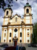
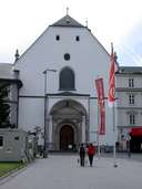
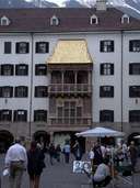
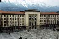
Image collection »Innsbruck-Stadt«

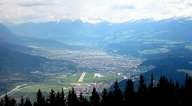
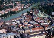
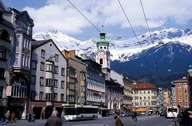
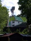
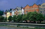
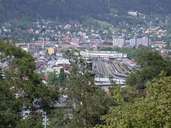
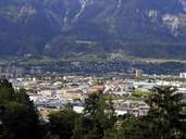
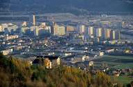
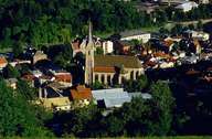
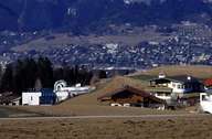
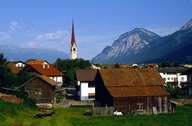
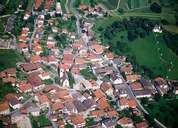
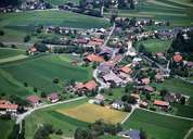
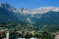
The community of Innsbruck is the provincial capital of Tyrol and as a town with its own statutes is also responsible for the administration of the district. The administrative area of the district Innsbruck-City stretches from behind the Nordkette mountains in the north and as far as the Patscherkofel in the south. Innsbruck is a major crossroad because it located where the Wipptal and Silltal valleys join the Inntal. Here the Brenner and the Inntal motorways intersect as do the railway lines, the airport is also of international importance. As the provincial capital Innsbruck has to take on important tasks for the province, among other things it is the seat of the provincial government, the provincial theatre and the court of jurisdiction, the ORF Austrian television studios, the provincial hospital and the universities. Innsbruck has also become famous for having hosting the Olympic Games, for which a number of facilities, for example, the combined bobsleigh and toboggan run in Igls, were built.

Tirol Atlas image No.°7650
Innsbruck with airport
Tirol Atlas image No.°5734
Innsbruck, Old Town
Tirol Atlas image No.°1128
Innsbruck, Maria-Theresien-Straße
Tirol Atlas image No.°7081
Zeughaus, Innsbruck
Tirol Atlas image No.°7079
Wiltener Basilika, Innsbruck
Tirol Atlas image No.°7056
Hofkirche, Innsbruck
Tirol Atlas image No.°7054
Golden Roof, Innsbruck
Tirol Atlas image No.°6591
Landhaus, Innsbruck
Tirol Atlas image No.°7052
Bergisel-Schanze, Innsbruck
Tirol Atlas image No.°7053
Andreas Hofer monument at the Bergisel, Innsbruck
Tirol Atlas image No.°5274
Innsbruck, Innstraße
Tirol Atlas image No.°7059
Main Station, Innsbruck
Tirol Atlas image No.°7348
Innsbruck, Reichenau
Tirol Atlas image No.°4994
Olympisches Dorf, Innsbruck
Tirol Atlas image No.°5289
St. Nikolaus quarter, Innsbruck
Tirol Atlas image No.°1447
Residental houses in Aldrans with a view of Innsbruck
Tirol Atlas image No.°5306
Amras quarter, Innsbruck
Tirol Atlas image No.°5737
District Arzl, Innsbruck
Tirol Atlas image No.°5735
District Vill, Innsbruck
Tirol Atlas image No.°6474
Innsbruck, Höttinger Graben with Nordkette
Tirol Atlas image No.°7679
Seegrube, Innsbruck
Overview map
Topographic map
  
Further links: Hazards Chronicle Tyrol, Weblink »Innsbruck«, Weblink »Wikipedia«, tiroLexikon