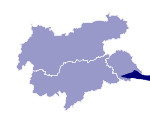
Image collection »Gailtaler Alpen«
The Gailtaler Alpen are located in the triangle between the East Tyrolean Pustertal and the Drau and Lesach valleys. This sub-group of the Lienzer Dolomiten lies within the area covered by the Tyrol Atlas. This limestone chain is characterised by steep rock faces with precipitous, jagged formations. Examples for this are the Spitzkofel (2717 m) and the Große Sandspitze (2770 m).

|

|
|
Further links: Weblink »Wikipedia«
