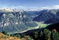
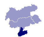
Image collection »Fleimstaler Alpen«
The Fleimstaler Alpen lie to the southwest of Bozen and border the Latemar-, Rosengarten and Palagruppe. The highest peak is the Cima d'Asta (2847 m). With their dark volcanic rocks they form a contrast to the light limestone of the Dolomites and are rich in minerals. The Lagorai-Kette chain to the south of the Fleimstal from Pinetano (in the west) to the Rollepass (in the east) was the scene of a number of battles during World War I. One can still see old military fortifications and mule tracks which are now used as hiking routes.

|

|
|
Further links: Weblink »Wikipedia«
