Image collection »Sextener Dolomiten«
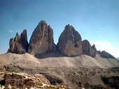
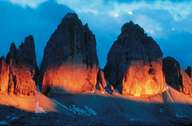
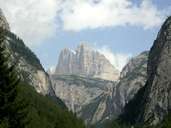
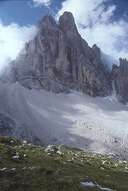
The Sextener Dolomiten stretch from the Hohensteintal over the Puster and Sexten valleys as far as the Cadinigruppe in the Ampezzaner Dolomiten. The highest peak is the Dreischusterspitze ((3145 m). The Drei Zinnen / Tre Cime di Lavaredo (2998 m) are among the most striking and best-known peaks in the Dolomites. The so-called Sextener Sonnenuhr (Sexten Sundial) is made up of five Dolomite peaks: from the vantage point at Heidegg in the Fischleintal they are the Neuner (Nine), Zehner (Ten), Elfer (Eleven), Zwölfer (Twelve) and Einser (One) Kofel peaks all of which are rock pointers which give the hour when the sun is above the respective peak. For two and a half years during World War I, battles with heavy losses were fought between Austria and Italy in the Sextener Dolomites. In 1981 the Naturpark Sextner Dolomiten (11,635 hectares) was established.
|
|
|
|
|
|