Image collection »Weertal«
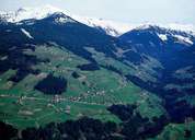
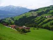
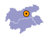
The Weertal runs in a southwest-northerly direction and only becomes more densely populated where it joins the Inntal (Weerberg, Kolsassberg). The Weertal used to provide an important access route to the Tuxertal because this is the shortest link from the Inntal. The Weertal was already used for purposes other than agriculture in the Middle Ages. Because of the high energy demands of the salt works in Hall, one ventured into almost inaccessible mountain regions in order to produce charcoal. The charcoal was generally brought down to the valley on sleds during the winter months, because transportation was too difficult over the steep, uneven slopes in the summer. When the salt works in Hall switched to hard coal in the 19th century, the charcoal burning sites, that had existed for some 400 years in the densely forested side valley of the Inntal, rapidly disappeared. The black soil still visible in places still bears witness to the area's charcoal burning past.

|

|

|
|
