Image collection »Überetsch«
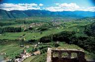
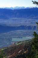
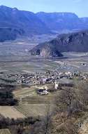
The Überetsch, a pre-glacial Etschtal, stretches from the slopes of the Mendelzug to Mittelberg 200 m above the bottom of the Etschtal. Glacial gravel and moraines filled up this area. Due to the mild climate and good soil intensive viniculture is possible. The beginning of viniculture in this area can be traced back as early as to the Middle Ages, when monks introduced vine plants. Numerous German dioceses and monasteries owned vineyards in South Tyrol, especially in Überetsch. The well known Südtiroler Weinstraße runs through this region. The construction of the Überetschbahn railroad, which runs from Bozen to Kaltern, and which was opened at the end of the 19th century, played an important role in the development of the region. In the 1960s the railroad was closed.
|
|
|
|