Image collection »Tschögglberg«
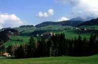
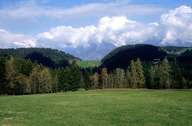
The Tschögglberg with its villages is a plateau covered with forests which stretches from Bozen to Meran at an altitude between 1100 and 1500 m. Its landscape was formed glaciers during the last ice age. The Tschögglberg resembles the Ritten climatically and geologically. Most of the plateau is formed by Bozner quartz porphyry. Further northeast Brixner quartz phyllit forms a geological border. The pastures with their larches are the vanishing remains of the old mountain farming culture and way of life. To gain more pasture land shady trees (i.e. firs) were cut down and the tall larches were left over. Today the Tschögglberg forms a recreation area for nearby Bozen.
|
|
|