Image collection »Tauferer Tal«
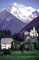
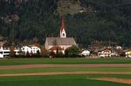
The Tauferer Tal, a side valley of the Pustertal, runs from the Pustertal to the community of Sand in Taufers. The broad valley, which opens up towards the north, lies in the old crystalline zone. The wide valley floor was intensively washed out and is marked by debris fans. Up to the 1970s agriculture was the most important economic factor in the entire valley, nowadays tourism has become the most important source of income.
|
|
|
Further links: Hazards Chronicle Tyrol, Weblink »Wikipedia«