Image collection »Ridnauntal«
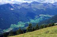
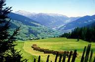
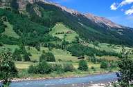
The valley, which politically belongs to Ratschings, starts near Sterzing and runs to the Stubaier Alpen. The valley geologically belongs to the Ötztaler Masse, which's composition is characterized by mica slate and granitic gneiss. Around 1500 more than 1000 miners worked in 70 different mines in the valley. Gold and lead were mined here. South - Tyrol's mining museum in Ridnaun - Schneeberg commemorates this time. The so called Schildhöfe farmhouses, which are typical for the Passeier, play an important role in the valley. The Counts of the Tyrol freed the owners of these farms from the tax burden. In addition to this tax exemption they were given the shooting and fishing right. For these privileges the farmers had to fight on the side of the sovereign in times of war. To make them easier to defend, the farmhouses were reconstructed into small castles.
|
|
|
|