Image collection »Planail«
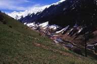
Since 1927 the valley of Planail has belonged to the village of Mals. Before the incorporation the valley formed a politically independent village. Due to harsh climatic conditions and difficult topographic conditions the 13 km long valley has only hardly been cultivated. The geology of the valley is dominated by the metamorphic rocks of the Ötztaler Alpen. Over centuries, parts of the valley belonged to the monastery of Chur. Under the lords of Chur the first settlements in the valley were built during the Schwaighof plantations. The sources in the upper part of the Planail play an important role in the water supply of Mals. Today the waters of the Punibach, which runs out of the valley, are used to generate electricity.
|
|