Image collection »Mittelgebirge von Tisens«
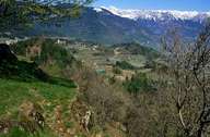
The low-mountain range of Tisens is a wide terrace, which stretches several 100 m above the Etschtal from the entrance to the Ultental to the slopes of the Gantkofel. The area around Tisens has long been settled. The oldest, prehistoric traces of human settlements can be found at the porphyry hill of St. Hippolyt. Till the 1930s, rye farming on a self-supply basis dominated agriculture in this region. Since the construction of the road over the Gampenpass (1935-38) fruit growing has become dominant. Today orchards and vineyards dominate the terrace. The farming of sweet chestnuts still contributes to the income of the farmers.

|
|
