Image collection »Malser Haide«
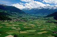
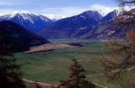
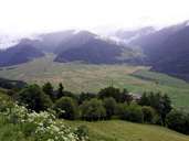
Malser Haide is an impressive alluvial fan which stretches from Plawenn (1725 m) down to Glurns (908 m) The villages of Burgeis, Schleis, Laatsch are situated at the western edge of the fan, whereas Mals and Tartsch lie at the eastern edge. The dry Alpine valley of the Vinschgau and the common downslope winds from the Reschen cause a desiccation of the farmland. To overcome this shortage in moisture people have built a widely ramified irrigation system (the so called "Waale") over the centuries. The Waale consist of numerous, widely ramified channels, which are used for sprinkling the fields in case of a drought. The irrigation with the Waal system was very labour intensive. Today the fields on Malser Haide are irrigated by overhead irrigation system.

|

|

|
|
