Image collection »Langtaufers«
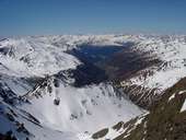
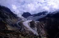
The 10 km long valley stretches from Reschensee to the Ötztaler Alps and belongs to the village of Graun. Today's hamlets within the valley were originally Schwaighof settlements and date back to the 15th century. Over centuries dairy farming was the main source of income for the people in the valley. The importance of the rearing of livestock is best reflected in the foundation of South Tyrol's first cattle farming association in 1895. Due to this association a shift from dairy farming towards specialized cattle breeding took place. The emerging alpinism made this remote high valley famous. Melag, one of the highest settlements in South Tyrol, is a good starting point for tours up to the Weißkugel, the second-highest mountain within the Ötztaler Alps.
|
|
|