Image collection »Afers«
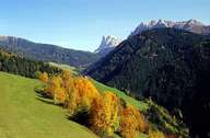
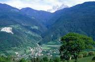
The approximately 15 km long Afertal branches off from the Eisacktal in the direction of the Dolomites at Albeins. It runs along the southern slope of the Plose. Although there is a good connection from Afers to the Gadertal over the Kofeljoch and the Würzjoch passes, Afers was settled from either Villnöß or the Eisacktal when the pressure of population in these areas increased to such an extent that new settlements had to be found. Afers was an independent community up to 1928. After that, however, the valley was amalgamated with St. Andrä to form one local community, and in 1941 it was incorporated into the local authority of Brixen. The settlements are located mainly in the centre of the valley.
|
|
|
Further links: Hazards Chronicle Tyrol