Image collection »Zwischentoren«
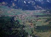
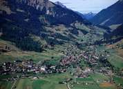
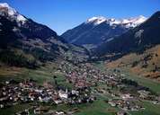
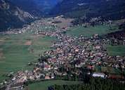
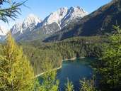
Zwischentoren stretches from Schloss Fernstein south of the Fernpass to the Ehrenberger Klause at Reutte. It is made up of the impressive Fernpass landslide landscape with its deeply embedded deep-blue lake, followed by the Lermoos or Ehrwald Becken whose settlements have been forced to the edges due to the moor or moorland landscape. The mountain frame is made up of the prominent sweeping mountain sides and peaks of the Wettersteingebirge and the Mieminger Kette. In the narrower sense Zwischentoren, with a valley watershed and a number of ascents and descents, stretches from Lermoos to Reutte. Particularly striking are the mountains whose green meadows reach up to the summits and the houses positioned against the weather which is an indication of the wealth of rainfall and the climatic disadvantages. The region of Zwischentoren is characterised by tourism and transit traffic.
|
|
|
|
|
|