Image collection »Virgental«
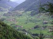
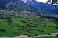
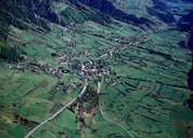
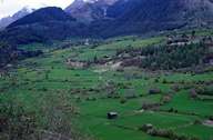
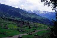
The Virgental constitutes the upper reaches of the River Isel that turns off in a westerly direction at Matrei. The isolated situation of the valley, due to the technical difficulties in building roads along the south side of the Alps, could be alleviated with the construction of the Felbertauern-Straße. Due to the Iselsschlucht, a north-south running incision by the Isel into the slate shell, the valley is divided into two at it centre which is highlighted in the two communities of Virgen and Prägraten. The emphasis is laid on meadowlands and animal farming, whereby sheep farming is relatively important. An important resource of this region that lies completely within the Nationalpark Hohe Tauern, is the harmonious union between the farming culture and the alpine landscape which forms a vital basis for the tourism here. Tourism is, however, limited to the summer with an onus on climbing and hiking. A particular attraction are the Umbalfälle falls at the head of the valley.
|
|
|
|
|
|