Image collection »Tuxer Tal«
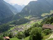
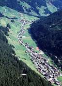
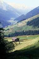
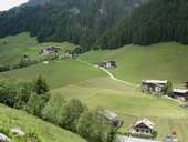
The approx. 15km long Tuxer Tal is the most westerly and important side valley of the Zillertal and, like the other source valleys of the Zillertal known mostly as "Gründe", flows over a steep terrace towards Mayrhofen. The head of the valley with Hintertux was settled from Schmirn over the Tuxer Joch and, before being united with Lanersbach further downstream in 1926, it belonged to the community of Schmirn. This was the reason why for centuries the inhabitants of Hintertux had their cemetery in the Wipptal which meant that they had to carry their dead over the Tuxer Joch and the Schmirntal to Mauern near Steinach. Road connections in the Tuxer Tal were built in the 1920s for the magnasite quarry in Lanersbach which has closed down in the meantime. Nowadays, however, apart from mountain farming life in the valley is determined by tourism through the skiing area of the Hintertuxer Gletscher and the thermal baths in Hintertux.
|
|
|
|
|
|