Image collection »Stanzertal«
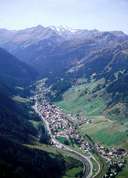
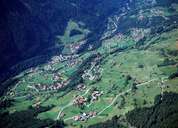
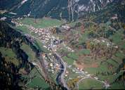
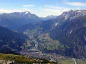
The Stanzertal forms the straight continuation of the Inntal from Landeck in a westerly direction as far as the Arlberg. The rocks of the Stanzertal are partly quartzphyllite and partly central gneiss. Slightly broader in the upper reaches interspersed with alluvial fans with villages on the north side, the valley becomes increasingly narrower and then offers only little space for settlements in the valley itself. These are to be found on the northern slopes as well as on the accompanying terraces towards Landeck. From a transport point of view the region was only connected with the west in the 19th century with the construction of the Arlberg Passstraße (1824) and the railway (1884). With the 14km long Arlberg Straßentunnel built in 1973, the longest tunnel in Austria and the Arlberg Schnellstraße road offers a winter-proof tourist route. The main settlement St. Anton am Arlberg enjoys an international reputation as a winter sport resort.
|
|
|
|
|
|