Image collection »Sölland«
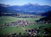
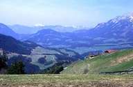
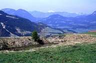
The name Sölland which is not often used, refers to this high valley that branches off from the Brixental southeast of Wörgl and which is an important west-east connection (Loferer Bundesstraße) to St. Johann and on further to the province of Salzburg. The Weißache that drains a section of the Sölland from east to west changes direction at the centre of the valley and flows towards Kufstein and through a narrow valley that plays an important role in the north-south transit route (in the direction of the Felbertauern). The scenic attraction of the Sölland lies in the contrast between the Kaisergebirge in the north with its precipitous limestone rock backdrop and the gentler forms of the grauwacken zone slates of the Hohen Salve ("Rigi" of Tyrol) in the south. These natural assets offer the ideal prerequisites for alpine winter sports and thus the region has developed into one of the biggest self-contained ski regions in Tyrol.
|
|
|
|