Image collection »Sellraintal«
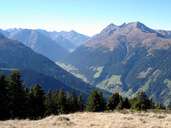
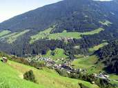
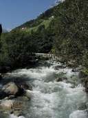
The Sellraintal is a slightly crooked-shaped side valley of the Inn, which in its inner valley first runs parallel to the Inntal and then runs into the Inn at Kematen. The valley is drained by the Melach that has cut itself a deep gorge at the exit of the valley at Kematen. The in part very steep slopes but due to its sunny position populated northern valley flank stands in stark contrast to the south flank which is wooded down into the valley and dissected by a number of side valleys. The Sellraintal is connected to the Ötztal through the Kühtai via the Ochsengarten. Of economic importance is the winter ski region of the Kühtai which belongs to the community of Silz and also the Kühtai power station with its Finstertal and Längental reservoirs which belong to the Sellrain-Silz powerstation group.
|
|
|
|