Image collection »Schmirntal«
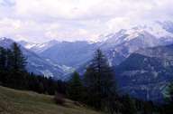
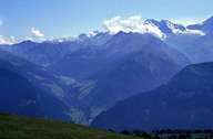
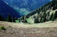
From its merging with the Valsertal at St. Jodok the Schmirntal runs approx. 12kms in an easterly direction as far as the Tuxer Voralpen and at the foot of the Olperer touches the main Tuxer range of the Zillertaler Alpen. Individual farms and hamlets are the dominant settlement types in the valley that, in the most part, lies within the zone of the soft slate shell of the Tauernfenster. Across the Tuxer Joch, at the furthermost head of the Zillertal, lies the historical connection to Hintertux that until 1926 used to belong to the community of Schmirn. A death chamber in Obern in the Schmirntal, a protected historical monument, reminds one that for centuries thos who had died had to be carried from Hintertux over the Tuxer Joch and through the Schmirntal to find their final resting place in Mauern near Steinach.
|
|
|
|