Image collection »Namloser Tal«
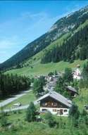
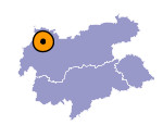
The outer Namloser Tal, deeply incised into steep limestone mountains, runs into the Lechtal in a gorge at Stanzach. The valley that with its soft, easily weathered Jura rocks formerly served as an area of mountain pastures for the large community of Imst, was, like the other southerly side valleys of the Lech, settled from the Imst region. The tiny community of Namlos in the heart of the valley has only been separated and independent of Berwang since 1949. A good road has led into the valley from Stanzach since the 1970s with a further connection as an excursion route to Berwang and Zwischentoren.

|
|
Further links: Hazards Chronicle Tyrol
