Image collection »Leukental«
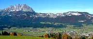
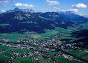
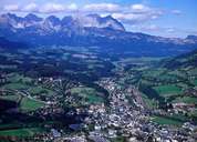
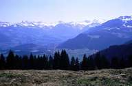
The name Leukental, not often used by the locals, used to describe the area from Pass Thurn in the south to the Bavarian border to the north of Kössen. Nowadays the name Leukental is understood to mean the section of the valley from Kitzbühel to Erpfendorf. The Ache that drains the valley frequently changes its name along its course from Jochbergerache to Kitzbühlerache and Großache and in Bavaria flows as the Tiroler Ache. Located at the centre of this broad valley floor are St. Johann and Kitzbühel which have the biggest populations in the whole region. They are both traffic hubs and administrative and tourist centres and are famous as skiing areas. The valley slopes are embedded in the soft slates of the grauwacken zone with scattered and impressive individual farmhouses. Above these at a higher altitude there is an area of alpine pastures with numerous, privately-owned pastures.
|
|
|
|
|
|