Image collection »Tiroler Gailtal«
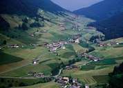
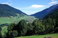
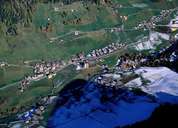
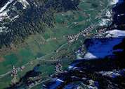
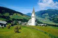
The western section of the valley furrow which is a tectonic fault line (periadriatic seam) between the towns of Sillian and Villach that separates the Central Alps from the Southern Alps (Karnische Alpen) is referred to as the Tiroler Gailtal. The Tiroler Gailtal consisting of mainly softer rock formations, stretches to the east as far as the Kartitscher Sattel (1525m), partly even over the valley watershed up to the provincial border with Carinthia. The former Trogtal, shaped by glacier ice, stretches out at Sillian 300m high above the Drautal where the Gailbach has cut a valley by means of deep post ice age erosion. In the area around Kartitsch the settlements are divided into hamlets and individual farms which are spread over the terraces and the valley floor, while Obertilliach, on the other side of the Kartitsch Sattel, is a densely built scattered village located on an alluvial fan.
|
|
|
|
|
|