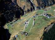
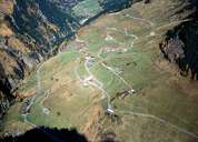
Image collection »Kaisertal«
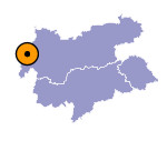
The Kaiserbach which flows from the Lechtaler Alps in the south runs into the Lechtal through a gorge in Steeg. At the exit of the valley resistant Main Dolomite characterises the geological structure. Kaisers is located in the shortest of all the side valleys of the Lech whose individual farms on the sun-facing slopes extend to an altitude of 1500 m. This makes Kaisers one of the highest settlements in the northern Kalkalpen. In contrast to the other orographic right hand side valleys of the Lech, Kaisers was settled and cultivated in the 13th century from the Stanzertal. After Kaisers the valley divides into the elongated Almajurtal and the Kaisertal itself, both of which are used as areas of mountain pastures. Modest mining took place in the Almajurtal in the 15th and 16th centuries.

|

|
|
