Image collection »Bschlaber Tal«
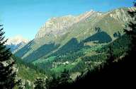
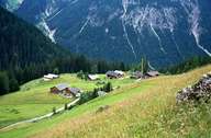
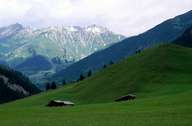
The Bschlaber Tal, a southern side-valley, runs into the Lechtal upstream from Elmen. Morphologically the valley changes from an impassable stretch of gorge at the valley exit to a v-shaped valley at the valley centre where the hamlets of Bschlabs are located on the sunny slopes. On a flat area at the head of the valley lies the settlement of Boden. Also included in the local community are the in the meantime deserted farmhouses of the settlement of Pfafflar on the road to the Hahntennjoch. This important pass, from a settlement point of view, to Imst and the Inntal has, through the further improvement of the road, become an attractive excursion route when it is not closed during the winter. The valley achieved international fame through the discussion of the possible construction of a hydro-electric power station on the Streimbach.
|
|
|
|