Image collection »Achental«
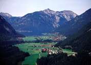
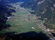
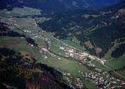
The valley, which is 17km long and located in a hollow between the Karwendel and Rofan mountain ranges, is drained to the north by the Achenbach stream and in the south extends 400 metres beyond the valley floor to the Inn Valley. The Achental is marked by the 9.4km long and up to 1km broad Achensee, the biggest lake in Tyrol. Because of the production of hydroelectric power at the Lake Achen powerplant (in Jenbach) the water in Achensee has been diverted to the River Inn since the 1930s. The lake itself, but also the numerous climbing and hiking possibilities, brought the first "holidaymakers" to Achensee in the mid-19th century. Tourism is nowadays the main source of income which also finds expression in the character of the settlements. A particular attraction is the Achensee railway, a steam-rack-railway that since 1889 has overcome the steep climb from the Inn Valley terminal to Achenseeand which creates a connection to the Achensee shipping service.
|
|
|
|