Image collection »Stuibenfall«
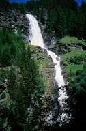
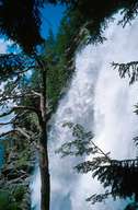
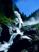
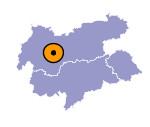
The Stuibenfall is the biggest waterfall in Tyrol. It was created some 9000 years ago after a massive rock fall. More than 2 km³ of rock broke away from the mountain side above Köfels, cutting off both the Ötztal and Horlachtal valleys. In the meantime the Horlachbach stream has found a new course falling more than 150 m in two tiers.
Among other sources the Horlachbach is fed by the melt waters of a number of glaciers and therefore runs higher in the summer. A part of the waters are diverted to the Sellrain-Silz power station to produce electricity. However, the Stuibenfall is still an imposing spectacle, especially during the summer months.

|

|

|
|
