Image collection »Brennerpass«
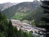
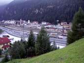
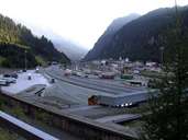
The Brennerpass is the most important pass between North and South Tyrol and is the lowest crossing point over the main alpine chain. As the Brenner is a pass that can be crossed all year round it was already used by people in the Stone Age. In Roman times two Roman roads led over the main alpine chain. The more important route of the two the Via Claudia Augusta which connected the Adriatic with the present city of Augsburg led over the Reschenpass and the Fernpass. At Bozen, however, another route branched off over the Brenner. Since then the pass has served as an important link between the people in North and South Tyrol but also for neighbouring countries. This is reflected among other things in the appreciable increase in traffic which has become a great problem for the local population. So that lorries can cover this route by rail in future the Brennerbasistunnel between Innsbruck and Frankensfeste should alleviate this problem.
|
|
|
|