Image collection »Arlbergpass«
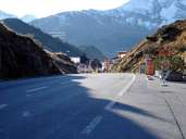
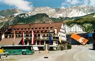
The Arlberg got its name from the Legföhren (lying pines), the so-called Arles with which the mountain used to be covered. The pass road leads through the famous tourist resorts of St. Anton and St. Christoph. So that the entire traffic did not have to roll over the pass the Arlberg Strassentunnel was built in 1978. It is 14 kilometres long and connects the villages of St. Anton and Langen. The tunnel insures that the transit connection remains open all year round and is no longer threatened by avalanches. The railway tunnel had already been constructed 100 years earlier. The top of the pass itself is located in the middle of St. Christoph. The Arlberg is both a water and a weathershed.
|
|
|
Further links: Hazards Chronicle Tyrol, Weblink »Wikipedia«