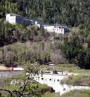
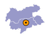
Image collection »Franzensfeste«
Fortress Franzensfeste lies on a bank, which is circumfluent on three sides by the Eisack River, where the Pustertal joins the Wipptal. Fortress Franzensfeste consists of two parts: the lower part, which looks like a wall, is called "Talwerk". The other part is called "Höhenwerk": the lower part, which looks like a wall, is called "Talwerk". The so called "Höhenwerk" was built above the "Talwerk" to protect it. The fortress was built in the 19th century under the reign of Emperor Franz I. during the Napoleonic Wars. Similar to the fortress in Nauders Franzensfeste was built in order to keep adversarial troops from marching through the Tyrol. Later the fortress was used by the Italian army. Today it is open to the public.

|
|
Further links: Weblink »Wikipedia«
