|
|
|
|
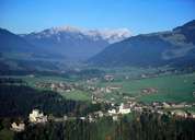
| AREA |
| Area (km²) |
Altitude distribution (SVG) |
10.4 |
52.3 |
| Altitude (m) |
703 |
262 |
| |
| |
| Landcoverage 2001 |
Chart |
| Forest area (ha) |
47.5% |
42.3% |
494 |
2211 |
| Waterbodies and moist areas (ha) |
1.0% |
2.7% |
10 |
140 |
| |
| Agriculturally used area (ha)* |
45.1% |
29.6% |
469 |
1550 |
| Built-up area (ha) |
3.1% |
18.2% |
32 |
952 |
| |
| Other coverages (ha) |
3.8% |
7.2% |
39 |
377 |
| |
| Settled Area 2002 |
Chart |
| Settled Area (km²) |
46.2% |
53.5% |
4.8 |
28.0 |
| Proportion of built-up area |
6.7% |
34.0% |
Chart
|
| |
| *leisure time-green included |
| Percentages have been rounded to one decimal place. |
| |
|
|